
Regions
Regions are the coloured areas that mark kingdoms, territories, and biomes on a World Map. You draw each one by hand, then style its fill, outline, and label.
Draw a region
Section titled “Draw a region”-
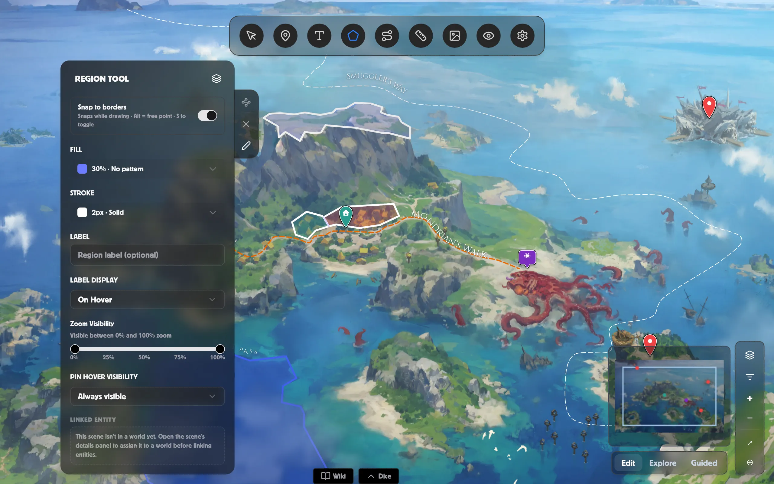
Pick the Region Tool from the toolbar.
-
Click around the map to drop the region’s corners.
-
Double-click (or right-click) to close the shape.
To adjust one later, select it and use the Draw / Edit tab on the panel’s edge — Edit lets you drag or delete individual corners.
Style the fill
Section titled “Style the fill”Open Fill in the Region panel:
- Fill Color and Fill Opacity — the flat colour and how solid it is.
- Pattern — overlay lines or texture instead of a flat wash: Lines — Horizontal / Vertical / Diagonal, Dots, or Hashed. Each pattern has its own Scale and Thickness.
Style the outline
Section titled “Style the outline”Open Stroke for the border line:
- Stroke Color, Stroke Width, and Stroke Opacity.
- Stroke Style — Solid, Dotted, or Dashed.
Label and visibility
Section titled “Label and visibility”- Label — name the region, and set Label Display to On Hover, Always, or Never. Once it has a label you get the full styling controls, including text that curves along the border — see Text & label styling.
- Zoom Visibility — show the region only within a zoom range, so big territories fade out as you zoom in.
- Pin Hover Visibility — reveal the region only while a chosen pin is hovered.
Link it to your world
Section titled “Link it to your world”Use the panel’s link field to tie a region to a faction in your world, so a territory always points back to who rules it. You can also record how control of a region changed over time — see Time-bound elements & history.
To remove a region, select it and click Delete Region.
Related
Section titled “Related”- Shared borders — snap and link two regions.
- Text & label styling — style a region’s label.
- World Map scenes — all the map tools.
- Time-bound elements & history — shifting faction control.